Sherlock Maps
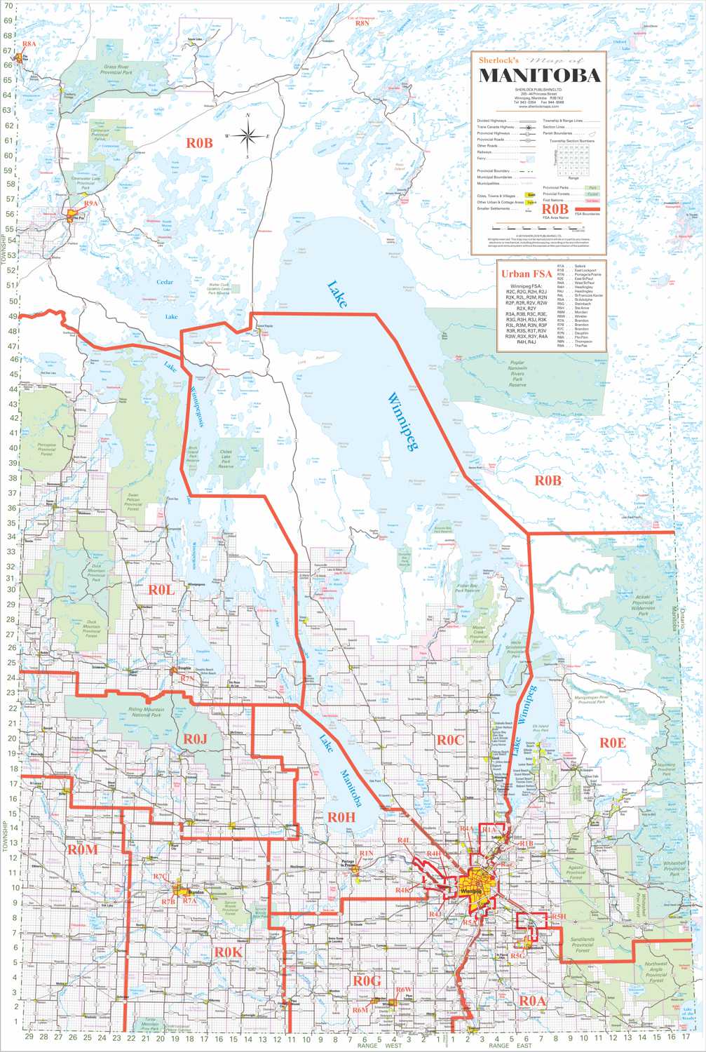
Manitoba Postal Code Wall Map with FSA Boundaries
Manitoba Postal Code Wall Map with FSA Boundaries
Regular price
$62.95 CAD
Regular price
Sale price
$62.95 CAD
Unit price
per
Couldn't load pickup availability
Every postal code zone in Southern Manitoba on one map. The first three digits of each postal code define a Forward Sortation Area (FSA), and this wall map shows every FSA boundary overlaid on a detailed black and white street map. Covers the same geography as the Manitoba South Colour map. Built for delivery and logistics operations, territory planning, and direct mail campaigns.
Materials
Materials
Gloss photo paper
Dimensions
Dimensions
16" x 20"
Includes a 0.25" white boarder
Shipping
Shipping
Free shipping on all Sherlock Neighbourhood's Maps.