Our Story
David Sherlock is a cartographer, entrepreneur and artist. Over the past 35 years, David has turned Sherlock Maps into an iconic local brand and stewarded Sherlock Publishing to become North America’s lone independent paper map publisher, all while navigating shifting social trends, emerging technology and, of course, the changing features in Western Canada.
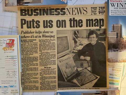
In 1987, David started making the first version of the City Map of Winnipeg. It took over two years to meticulously capture every detail in the city in order to publish a high quality map, including not only every street, but details such as each Church, crosswalk, school and community centre. His efforts involved driving every street in the city, exploring all of Winnipeg’s neighbourhoods along the way. Since the first edition, over half a million people have flipped though a Sherlock Map.
Sherlock Maps continues to be a staple of life in Winnipeg and Calgary. The signature maps can be seen in the cars of hockey parents, integrated into firefighters navigation systems, and displayed in local businesses.